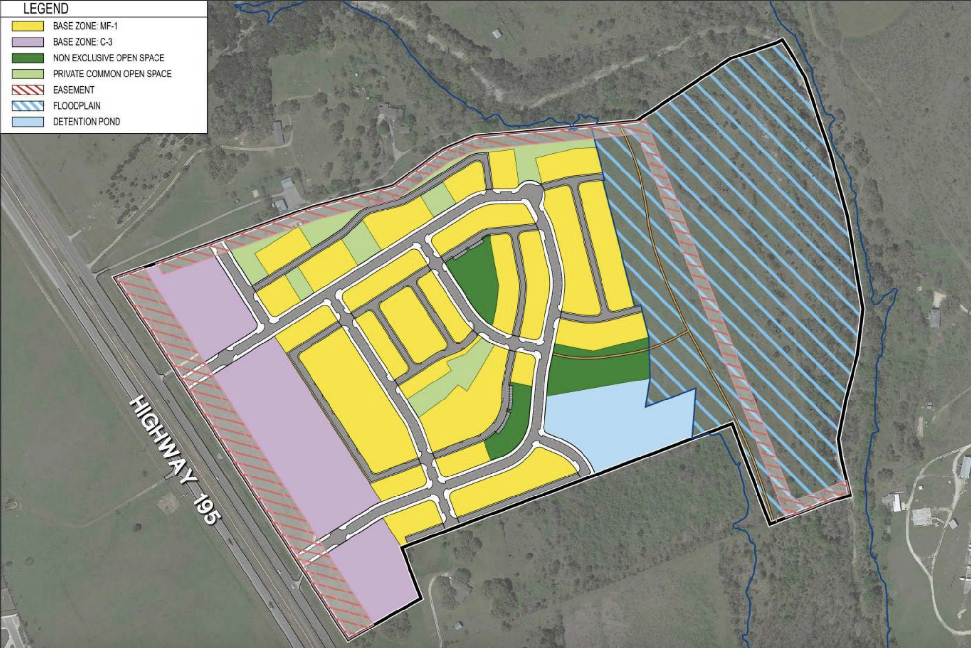
This map shows where the commercial, residential, greenspace and floodplain are located within the property. The purple shows the commercial buildings toward the front, with the yellow residential being behind it. The light green shows private common spaces and the dark green shows public common spaces. The back of the property is hatched in blue because it is in a flood plain. However, there will be a multi-use trail on that part of the property. (Courtesy of City of Georgetown)
Georgetown City Council unanimously approved the rezoning of approximately 85 acres from agricultural to a Planned Unit Development with base zonings of low-density multi-family and general commercial, bringing up to 425 units with a minimum of three different housing styles. The parcel of land is located off State Highway 195 near Interstate 35 near the Villages of Berry Creek and ...