
City council approves requests for incoming development projects
Incoming developments dominated Georgetown City Council discussions Tuesday.
City council approved rezoning requests for commercial and residential development projects, including a headquarters for Lone Star Circle of Care at the Old Carver School site, as well as the annexation of 92 acres for a business park.
Lone Star Circle of Care headquarters
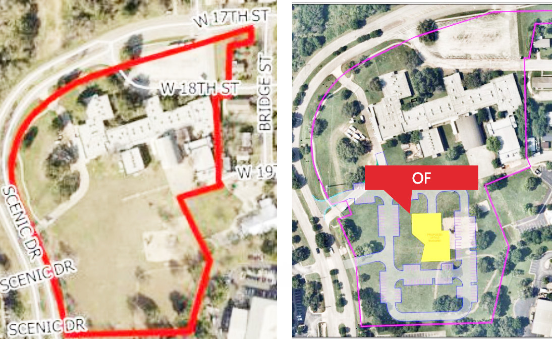
Council members unanimously approved rezoning the 11.7 acre Old Carver Elementary School site at 1100 West 17th Street for an office headquarters for Lone Star Circle of Care, a nonprofit organization providing healthcare to patients in need throughout Texas.
The land was rezoned from residential single-family to office zoning classification. The action follows unanimous approval for the city’s Planning and Zoning Commission.
Old Carver Elementary School is just north of The Caring Place facility and east of the St. David’s Georgetdown medical complex. The West 17th Street site was previously owned by Georgetown ISD as Washington Carver Elementary School, which served Georgetown’s African American community during a time when schools were still segregated. The school was desegregated in 1967 and operated until 2015, when classes moved into a new facility. The land was sold by the district in 2021.
According to assistant planning director Travis Baird, the existing school building will be integrated by developers into the Lone Star Circle of Care facility design. The city anticipates construction of one additional building on the site, as well as additional parking spaces.
Fidelis Georgetown
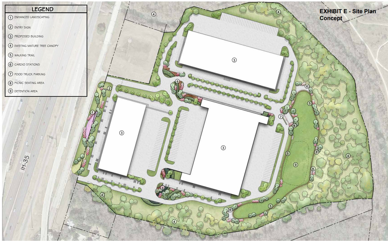
Georgetown City Council approved rezoning land from agricultural use to a planned unit development, also known as a PUD, with a base zoning designation of business park during its Tuesday meeting. The 57-acre site will house about 530,000 square feet of flex office space and assembly manufacturing, located north of the State Highway 130 toll and Interstate 35 interchange.
The project is being developed by Fidelis, a company headquartered in Houston that builds retail, office, multi-family and industrial facilities. Fidelis rents its properties to well-known retailers, including Marshalls, HEB, Academy and Dick’s Sporting Goods, according to the company.
Georgetown planning director Sofia Nelson said the land at 2990 North I-35 is in one of the city’s future land use map’s regional centers, designated for larger retail, mixed-use and high density projects.
Once developed, the land will include three large buildings with multiple uses possible. It will also include a landscaped greenspace, a detention pond, a walking path, permanent seating and a food truck pavilion.
The rezone request was passed with a 5-2 vote, with District 1 Council Member Amanda Parr and District 6 Council Member Jake French opposing.
Bridge Business Park
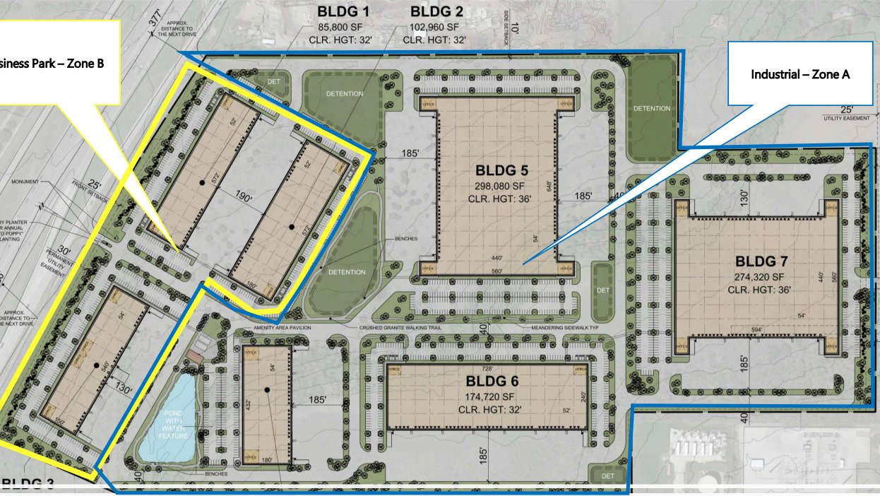
Council also approved an annexation request for 92-acres of land located 5501 South I-35. The request — which includes the annexation of Rabbit Hill Road all the way down to Mays Street — was made by the Bridge Investment Group to construct a campus-style business park.
Once developed, the project will include five buildings and bring roughly 300,000 square feet of space which could be used as office, warehouse or distribution facilities by tenants.
ThelandwasannexedasaPUD, with the base zoning of business park and industrial. The site has a future land use designation as an employment center, which is intended for employment generating uses.
Annexation was approved with a 6-1 vote, with District 7 Council Member Ben Stewart opposing.
The Junction at 1460
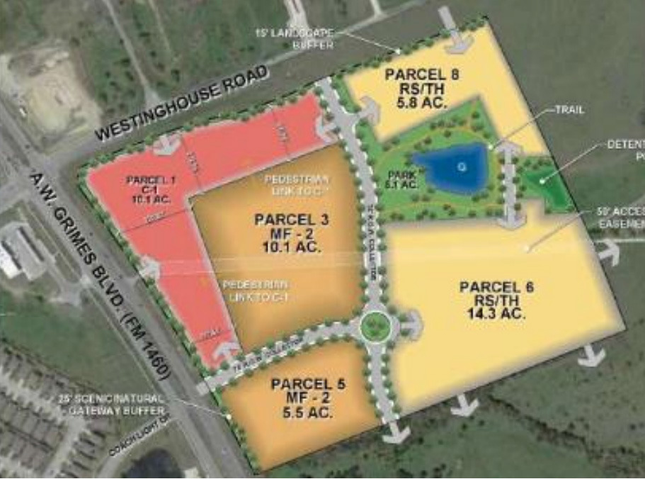
More housing is coming to Georgetown. A rezone request for about 57 acres located at the southeast corner of Westinghouse Road and Farm to Market Road 1460 was approved Tuesday, making way for The Junction at 1460.
Planned by Blackburn Communities, Junction at 1460 will bring residential housing — both single and multi-family — as well as a 5-acre park and roughly 10 acres dedicated to commercial use.
Land will be rezoned from its agricultural designation to a PUD with base zonings of residential single-family, high density multi-family and local commercial.
According to the 2030 Comprehensive Plan, the area is viewed as an urban corridor, which means retail, commercial, office, mixed-use and medium-density residential use, Ms. Nelson said.
The rezone request was passed unanimously by the council.