Development
A schematic for the Georgetown YMCA shows an overhead view of the parking lot, the building and the outside courts and pools that will be a part of the two-story building. (Rendering courtesy City of Georgetown)
Groundbreaking for bond-approved Georgetown YMCA estimated for FY27
Strategic Projects Manager Caroline Stewart presents the deals of the Term Sheet with Recharge Water LP to Georgetown City Council during the May 12 city council workshop. (Photo by Kaitlyn Wilkes)
City of Georgetown pursues 30-year water agreement to meet future demand
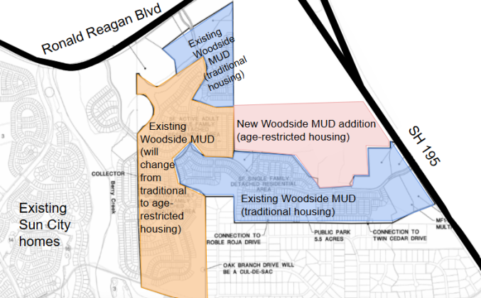
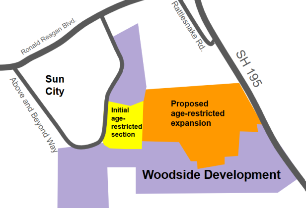
The land around the Rockbluff and Yearwood MUDs is being rezoned to accommodate for future housing in the area.
Georgetown adjusts plan to support proposed subdivision in quarry near Sun City
Changes to Georgetown’s building code aim to make development more accessible
Georgetown City Council will approve the updated Unified Development Code in July and August. (Photo by Kaitlyn Wilkes)
Changes to Georgetown’s building code aim to make it more accessible
An initial plan for the NOVA mixed-use project — which spans two tracts of land — shows C3 commercial zoning along Shell Road, as well as high- and low-density multi-family. However, the commercial zoning was changed to C1 and the residential was changed to all low-density multi-family with a maximum of 10 units per acre after a city council vote April 14. This plan shows tract one. (Courtesy City of Georgetown)
After trial and error, city council approves Shell Road development
Rick Ortiz, people operations team head at Compal USA Technology Inc., thanks the Commissioners Court for approving the tax abatement on April 14. Photo by Nalani Nuylan.
Williamson County gives tax incentives to Taiwanese AI company
Matt Matthews, with real estate developer Freehold Capital Management, told council about the other developments the company has done in the area and what the Yearwood development could look like once finished. (Photo by Kaitlyn Wilkes)
Quarry site north of Sun City could be converted to 1,894-home development
City of Georgetown in final phases of Unified Development Code adoption
This map shows where the commercial, residential, greenspace and floodplain are located within the property. The purple shows the commercial buildings toward the front, with the yellow residential being behind it. The light green shows private common spaces and the dark green shows public common spaces. The back of the property is hatched in blue because it is in a flood plain. However, there will be a multi-use trail on that part of the property. (Courtesy of City of Georgetown)