Georgetown City Council

This map of the Georgetown area shows current response times from Georgetown fire department, with green being under the 10 minute response time goal and red showing places where it takes longer than 10 minutes to arrive. (Courtesy Georgetown Fire Department)

This map of the Georgetown area shows current response times from Georgetown fire department, with green being under the 10 minute response time goal and red showing places where it takes longer than 10 minutes to arrive. (Courtesy Georgetown Fire Department)

New fire station to improve response times near Teravista

Over the next two fiscal years, the Georgetown Fire Department will design, build and put into operation an eighth fire station at Westinghouse Road and Farm to Market 1460 and a pilot EMS model on State Highway 29.
This map shows where the commercial, residential, greenspace and floodplain are located within the property. The purple shows the commercial buildings toward the front, with the yellow residential being behind it. The light green shows private common spaces and the dark green shows public common spaces. The back of the property is hatched in blue because it is in a flood plain. However, there will be a multi-use trail on that part of the property. (Courtesy of City of Georgetown)

This map shows where the commercial, residential, greenspace and floodplain are located within the property. The purple shows the commercial buildings toward the front, with the yellow residential being behind it. The light green shows private common spaces and the dark green shows public common spaces. The back of the property is hatched in blue because it is in a flood plain. However, there will be a multi-use trail on that part of the property. (Courtesy of City of Georgetown)

New 85-acre subdivision in north Georgetown has eight housing options

Georgetown City Council unanimously approved the rezoning of approximately 85 acres from agricultural to a Planned Unit Development with base zonings of low-density multi-family and general commercial, bringing up to 425 units with a minimum of three different housing styles.

Georgetown ponders 2027 bond, possible projects still uncertain

Nick Woolery Georgetown residents could see another bond election in May 2027, although the specific projects up for vote have not yet been decided. The last city bond election took place in November 2023 and included multiple facility projects and building expansions.
Cars on January 14 pass the Snead Drive/Blue Springs intersection with SE Inner Loop, one block east of Austin Avenue and Interstate 35. A traffic signal and median will be added to the area in the future to improve safety. (Photo by Kaitlyn Wilkes)

Cars on January 14 pass the Snead Drive/Blue Springs intersection with SE Inner Loop, one block east of Austin Avenue and Interstate 35. A traffic signal and median will be added to the area in the future to improve safety. (Photo by Kaitlyn Wilkes)

City of Georgetown to upgrade intersections, traffic signals across city

Nine intersections and all 82 of Georgetown’s traffic signals are actively being updated to improve traffic flow and be in line with city standards, according to a city council workshop presentation by Transportation Manager Lua Saluone.
A concept plan for the Bell-Sharkey Municipal Utility District shows 395 lots east of Inner Loop and north of University Avenue, with the San Gabriel River to the north. The orange lots are 47 feet by 125 feet, and the yellow lots are 52 feet by 125 feet.

A concept plan for the Bell-Sharkey Municipal Utility District shows 395 lots east of Inner Loop and north of University Avenue, with the San Gabriel River to the north. The orange lots are 47 feet by 125 feet, and the yellow lots are 52 feet by 125 feet.

Pulte Group looks to add another subdivision in east Georgetown

Sun City developer Pulte could bring a new Municipal Utility District with about 395 homes to the east side of Georgetown between University Avenue, NE Inner Loop, the 130 Toll and the south shore of the San Gabriel River.
City council approved a new, simpler design that was more affordable on December 9. The design still includes areas where residents can observe the river and landscape. (Courtesy Freese and Nichols)

City council approved a new, simpler design that was more affordable on December 9. The design still includes areas where residents can observe the river and landscape. (Courtesy Freese and Nichols)

Soaring price makes Georgetown change course on pedestrian bridge design

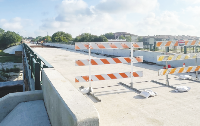
Approved designs for the Austin Avenue pedestrian bridges — which were okayed by Georgetown City Council in the spring of 2024 — will be changed, as the costs for the previously planned truss-inspired bridges have significantly increased due to an underestimation in steel quantities required.
Designed by architect Miguel Rosales, Georgetown City Council selected a concept in March 2024 for two pedestrian bridges along Austin avenue. Austin engineering and planning company Freese and Nichols was then awarded a design contract to finalize plans for the amount of $2.8 million. Construction on the project has not yet started. (Rendering courtesy City of Georgetown)

Designed by architect Miguel Rosales, Georgetown City Council selected a concept in March 2024 for two pedestrian bridges along Austin avenue. Austin engineering and planning company Freese and Nichols was then awarded a design contract to finalize plans for the amount of $2.8 million. Construction on the project has not yet started. (Rendering courtesy City of Georgetown)

Soaring price could jeopardize Austin Avenue truss-inspired pedestrian bridges

Approved Austin Avenue pedestrian bridges — which were okayed by Georgetown City Council in 2024 in an effort to create a gateway into downtown —- are in jeopardy as the costs have significantly increased due to an underestimation in steel quantities required.
A Georgetown property, which used to have a house on it, has been zoned C3 since the 1970s. It is now zoned C1, the city’s lowest commercial zoning. (Photo by Kaitlyn Wilkes)

A Georgetown property, which used to have a house on it, has been zoned C3 since the 1970s. It is now zoned C1, the city’s lowest commercial zoning. (Photo by Kaitlyn Wilkes)

Commercial rezoning draws opposition from neighbors

Despite trepidations from residents of the Track-Ridge-Grasshopper neighborhood, Georgetown City Council unanimously approved a zoning change on November 25 for a vacant property at 501 West Eighth Street. The property had been zoned C3, which is the highest-density commercial zoning the city has.