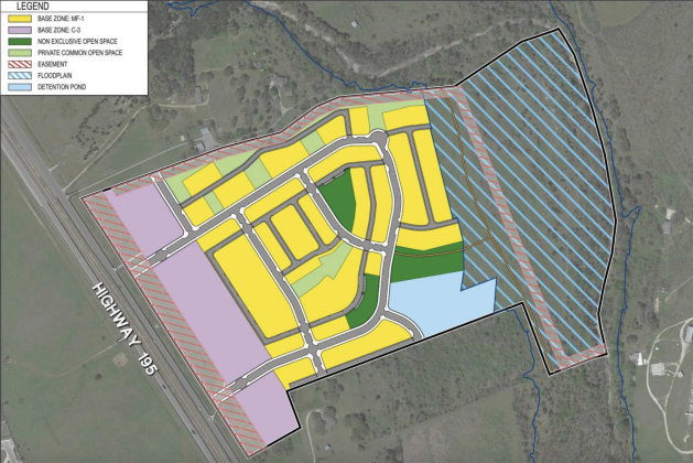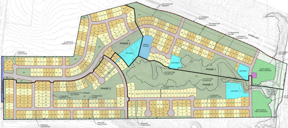
This map shows how the addition to the Woodside MUD would be plotted, with the different lot sizes color-coded. Woodside and Pulte homes are directly to the west of the tract of land. (Map courtesy City of Georgetown)
Developer seeks more age-restricted homes near Sun City
Kaitlyn Wilkes
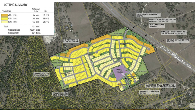
A developer is seeking approval to add 521 housing units to the Woodside Municipal Utility District near Sun City, a proposal that would expand the planned community to nearly 1,700 homes, increase the amount of age-restricted housing in the area, and has drawn skepticism from some Georgetown City...
Wednesday, June 3, 2026